Almean geology
Posted: Wed Dec 08, 2010 1:53 am
I’d like to open a question about an almost unexplored field: Almean geology.
I found some indications on Almeopedia about the origins of some mountain ranges and places, but I think the importance of geology is still underestimated, as I found no reports of earthquakes in the history pages.
On Earth, earthquakes and volcanic eruptions played a minor but at least significant role in the past (and they play still today), with cities destroyed and left, or rebuilt, sometimes losing importance. Earthquakes sometimes played a great role in architecture, by eliminating old style buildings and giving new material from the ruins to rebuild. Volcanic eruptions played a minor role in history, as not so many volcanoes are found in places where major civilizations developed. But think of the city of Pompeii in Italy, or the (not sure) role of the Santorini eruption in the disappearance of the Minoan civilization on Crete.
Certainly the influence of this kind of events are limited to geologically active zones, while in other places a generation could ever live without witnessing a single earthquake in their entire lives.
As written in the Almeopedia, Almea is surely a geologically active planet, as it is stated that continents are moving (Neinuoi and Luduyn peninsula). A lack of earthquakes and volcanic activity could imply that Almea is losing its internal heat and the tectonic movement is stopping or has just stopped. But this means that the planet is slowly dying, with terrible consequences over life, although in a very long time.
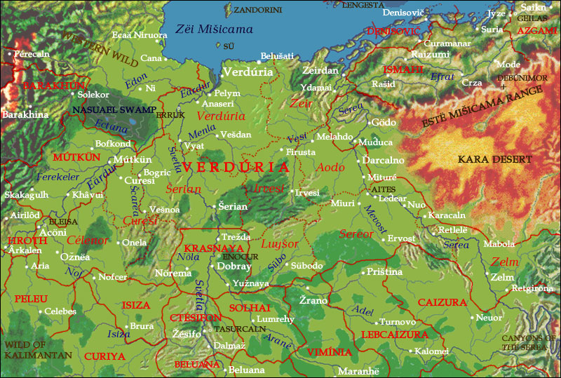
I thought of a geologically active scenario, with plates moving forming the present continents. It’s impossible to sketch the seismic zones without drawing the tectonic plates that moved to form the continents. Earthquakes usually manifest themselves at plate boundaries while inside them are very rare. As mountains on Earth could form only when the crust was bent and raised by tectonic forces between plates, I thought to draw the boundaries according to the existing mountains on the maps, which I studied very well. (Only for eastern Ereláe until now).
The sketch which came out is a collage of different plates, which I named according to the area they form or the major feature they contain. This apparently confusing situation about the plates are not uncommon on Earth. The Chinese area, and most of eastern Asia was formed by the fusion of multiple micro-plates. I drew the major plate, on the north, the Nanese-Dhekhnami plate, forming the biggest part of the continent, with which is slowly colliding the Eretald plate (Eretald and the Barbarian plain). South of them the Luduyn plate is colliding with the Eretald plate with more force. The situation in the East seems to be a little more complicated as the Xengiman could exist only if the sea Gurt Jeori is something like a big shallow gulf, part of the continent, thus forming the Xurnese plate. The relatively low altitude of the mountains in northern Qaraumia seems to indicate that the Qarau plate (easternmost coast of Ereláe) is something like the Pacific plate on Earth, which is colliding with the North American plate along the S. Andreas fault, sliding one alongside the other. The Skourene plate (including the Lenani steppe, Skouras and the Littoral) seems to be an ancient, worn out plate, which is wedged between the Xurnese and the Qurau plate. Between the Eretald plate and the Xurnese one seems to be there a micro-plate: the Bolon plate.
So we can figure out the faults, which mark the boundaries of the plates, and thus the most seismically active areas of the continent. As the Diqun Bormai are presented as something like Himalaya on Earth, they certainly are the most seismic zone on Ereláe. The Koranax, as one closest region to the mountain range but surely part of the Xurnese plate, is continuously hit by earthquakes, even very strong ones. The city of Gurdago can nevertheless escape strong earthquakes, thank to its position in the extreme south of the peninsula, maybe out of the fault.
The most interest part is the boundary between the Eretald plate and the Nanese-Dhekhnami one. This fault runs from the Elkarin mountains through Flora, Kebri and the Ctelm mountain. A mountain island as Kebri is usually hit by strong earthquakes, as part of a range of mountains. The same fate could happen to Érenat and to Barakhun. Also the mountain area of Ismahi seems to be good for seismic activity, although not so intensively. Flora seems to be a very young island and could be struck by strong but rarer earthquakes. As the Zëi Mišicama could be so active, the Eretald coast could be in potential danger of tsunamis. (As witnessed on Earth, not all earthquakes led to tsunamis, but they can influence history, as the 1755 Lisbon tsunami, which influenced the colonization history of Portugal and the European philosophy).
Other risky areas are the Lenani steppe around Lenani lake, the Gelihur peninsula, and with less risks, the mountain range on the Mnau peninsula. The Littoral could endure some earthquakes, but not so devastating as other regions.
Volcanoes can be a rarer geological feature, but usually present within a little distance from fault lines. They can be continuously active or dormant but dangerously recharging their magma chambers. (As example, nobody knew of the volcanic nature of mount Vesuvius before its 79 AD eruption). There are many kinds of volcanoes, usually near a fault line, it is easy to find dormant but explosive volcanoes (think of the volcanoes near the American West Coast), while in correspondence to hot spots usually there are non-explosive volcanoes, whose lava flow quickly to the sea or the ground around it.
Another unconsidered geological feature is the influence of rivers. Rivers carry a uncountable mass of sediments to the sea, and, especially when they form a delta, they change the coastline, in a very short time (Think of the delta of the Mississippi, which is advancing very rapidly in the centuries). Thus the Xengi delta cannot have been remaining the same in 3000 years of history. If we take the coastline drawn in maps depicting the Xengiman around 0 z.e., in 3480 the delta would probably have reached the Tanel peninsula. Also the alluvial plains usually are subjected to disastrous floods which change the course of the rivers, so that a city can lose its access to the river itself (a city near my town was founded on the left side of its river, and now after 2000 year it is located on the right side, after some floods in the Middle Ages: as control was lost the river moved, the city did not). Rivers can become tributary to major rivers, or begin to flow directly to the sea in their entire lifetime.
Also interesting is the Skourene sea. Compared with Baltic sea on Earth, it could be formed by the sinking of the ground, pressed by the enormous weight of the ice during an hypothetical ice age in the distant past, as it lies near the South Pole.
Maybe we can think that the iliî, with their advanced technology, in past times developed some kind of machinery which can still dissipate the enormous seismic energy, preventing earthquakes. But this is something like killing Almea, as tectonic activity shows the planet’s vitality and refuels the atmosphere via volcanoes with new gases, thus I don’t think the iliî would have made something against the nature of their planet, even if geological events are so dangerous.
I found some indications on Almeopedia about the origins of some mountain ranges and places, but I think the importance of geology is still underestimated, as I found no reports of earthquakes in the history pages.
On Earth, earthquakes and volcanic eruptions played a minor but at least significant role in the past (and they play still today), with cities destroyed and left, or rebuilt, sometimes losing importance. Earthquakes sometimes played a great role in architecture, by eliminating old style buildings and giving new material from the ruins to rebuild. Volcanic eruptions played a minor role in history, as not so many volcanoes are found in places where major civilizations developed. But think of the city of Pompeii in Italy, or the (not sure) role of the Santorini eruption in the disappearance of the Minoan civilization on Crete.
Certainly the influence of this kind of events are limited to geologically active zones, while in other places a generation could ever live without witnessing a single earthquake in their entire lives.
As written in the Almeopedia, Almea is surely a geologically active planet, as it is stated that continents are moving (Neinuoi and Luduyn peninsula). A lack of earthquakes and volcanic activity could imply that Almea is losing its internal heat and the tectonic movement is stopping or has just stopped. But this means that the planet is slowly dying, with terrible consequences over life, although in a very long time.
I thought of a geologically active scenario, with plates moving forming the present continents. It’s impossible to sketch the seismic zones without drawing the tectonic plates that moved to form the continents. Earthquakes usually manifest themselves at plate boundaries while inside them are very rare. As mountains on Earth could form only when the crust was bent and raised by tectonic forces between plates, I thought to draw the boundaries according to the existing mountains on the maps, which I studied very well. (Only for eastern Ereláe until now).
The sketch which came out is a collage of different plates, which I named according to the area they form or the major feature they contain. This apparently confusing situation about the plates are not uncommon on Earth. The Chinese area, and most of eastern Asia was formed by the fusion of multiple micro-plates. I drew the major plate, on the north, the Nanese-Dhekhnami plate, forming the biggest part of the continent, with which is slowly colliding the Eretald plate (Eretald and the Barbarian plain). South of them the Luduyn plate is colliding with the Eretald plate with more force. The situation in the East seems to be a little more complicated as the Xengiman could exist only if the sea Gurt Jeori is something like a big shallow gulf, part of the continent, thus forming the Xurnese plate. The relatively low altitude of the mountains in northern Qaraumia seems to indicate that the Qarau plate (easternmost coast of Ereláe) is something like the Pacific plate on Earth, which is colliding with the North American plate along the S. Andreas fault, sliding one alongside the other. The Skourene plate (including the Lenani steppe, Skouras and the Littoral) seems to be an ancient, worn out plate, which is wedged between the Xurnese and the Qurau plate. Between the Eretald plate and the Xurnese one seems to be there a micro-plate: the Bolon plate.
So we can figure out the faults, which mark the boundaries of the plates, and thus the most seismically active areas of the continent. As the Diqun Bormai are presented as something like Himalaya on Earth, they certainly are the most seismic zone on Ereláe. The Koranax, as one closest region to the mountain range but surely part of the Xurnese plate, is continuously hit by earthquakes, even very strong ones. The city of Gurdago can nevertheless escape strong earthquakes, thank to its position in the extreme south of the peninsula, maybe out of the fault.
The most interest part is the boundary between the Eretald plate and the Nanese-Dhekhnami one. This fault runs from the Elkarin mountains through Flora, Kebri and the Ctelm mountain. A mountain island as Kebri is usually hit by strong earthquakes, as part of a range of mountains. The same fate could happen to Érenat and to Barakhun. Also the mountain area of Ismahi seems to be good for seismic activity, although not so intensively. Flora seems to be a very young island and could be struck by strong but rarer earthquakes. As the Zëi Mišicama could be so active, the Eretald coast could be in potential danger of tsunamis. (As witnessed on Earth, not all earthquakes led to tsunamis, but they can influence history, as the 1755 Lisbon tsunami, which influenced the colonization history of Portugal and the European philosophy).
Other risky areas are the Lenani steppe around Lenani lake, the Gelihur peninsula, and with less risks, the mountain range on the Mnau peninsula. The Littoral could endure some earthquakes, but not so devastating as other regions.
Volcanoes can be a rarer geological feature, but usually present within a little distance from fault lines. They can be continuously active or dormant but dangerously recharging their magma chambers. (As example, nobody knew of the volcanic nature of mount Vesuvius before its 79 AD eruption). There are many kinds of volcanoes, usually near a fault line, it is easy to find dormant but explosive volcanoes (think of the volcanoes near the American West Coast), while in correspondence to hot spots usually there are non-explosive volcanoes, whose lava flow quickly to the sea or the ground around it.
Another unconsidered geological feature is the influence of rivers. Rivers carry a uncountable mass of sediments to the sea, and, especially when they form a delta, they change the coastline, in a very short time (Think of the delta of the Mississippi, which is advancing very rapidly in the centuries). Thus the Xengi delta cannot have been remaining the same in 3000 years of history. If we take the coastline drawn in maps depicting the Xengiman around 0 z.e., in 3480 the delta would probably have reached the Tanel peninsula. Also the alluvial plains usually are subjected to disastrous floods which change the course of the rivers, so that a city can lose its access to the river itself (a city near my town was founded on the left side of its river, and now after 2000 year it is located on the right side, after some floods in the Middle Ages: as control was lost the river moved, the city did not). Rivers can become tributary to major rivers, or begin to flow directly to the sea in their entire lifetime.
Also interesting is the Skourene sea. Compared with Baltic sea on Earth, it could be formed by the sinking of the ground, pressed by the enormous weight of the ice during an hypothetical ice age in the distant past, as it lies near the South Pole.
Maybe we can think that the iliî, with their advanced technology, in past times developed some kind of machinery which can still dissipate the enormous seismic energy, preventing earthquakes. But this is something like killing Almea, as tectonic activity shows the planet’s vitality and refuels the atmosphere via volcanoes with new gases, thus I don’t think the iliî would have made something against the nature of their planet, even if geological events are so dangerous.
