
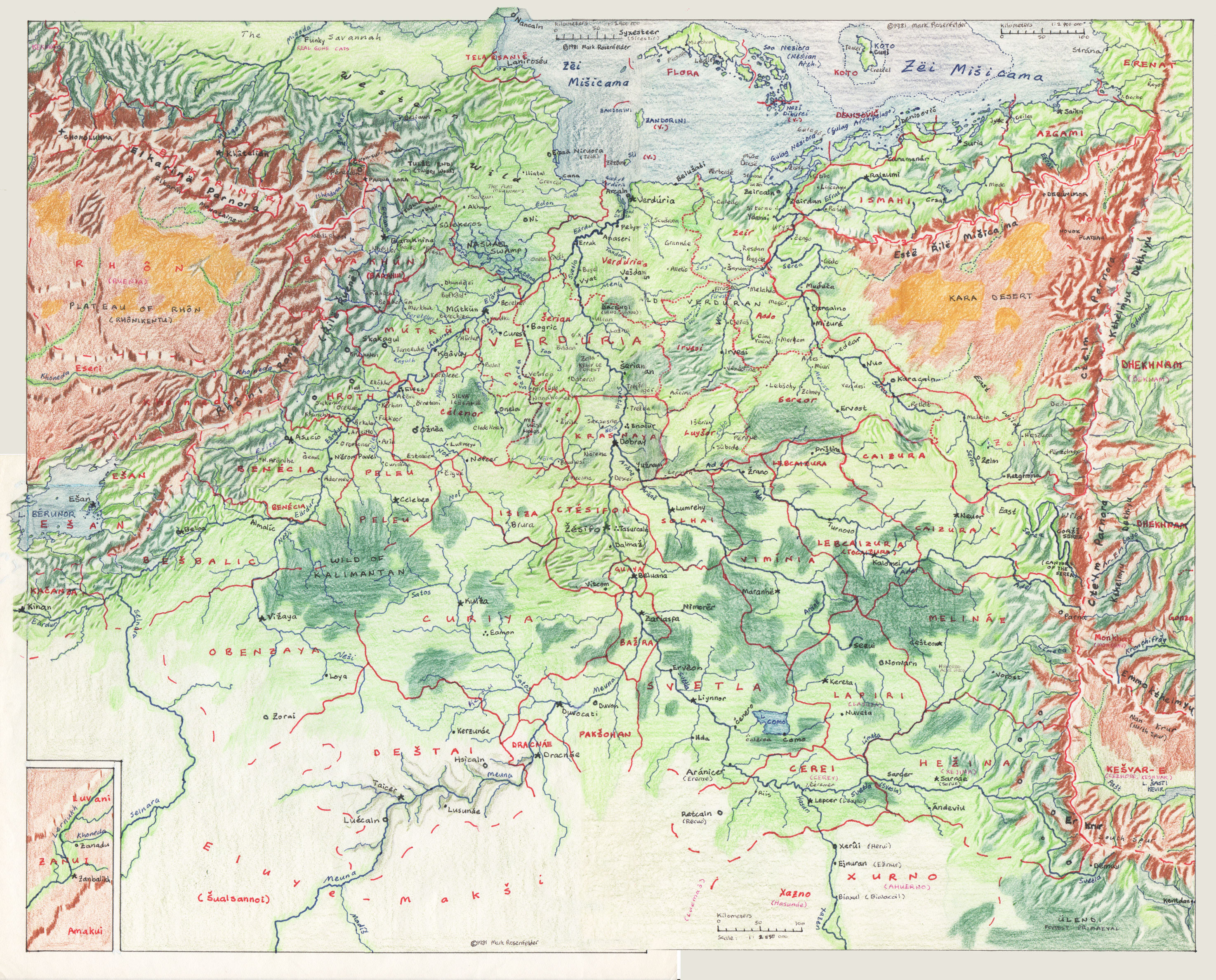
I realized recently that I have some nice maps of Eretald that I've never posted, and which are better references than anything online. These are really big, about 2 meg each.
First, a huge map of Eretald. This was made back in (gulp) 1981— 36 years ago. It was made in four parts— I stitched them together tonight in Photoshop. How we did this back in the caveman days: pen and colored pencils. The maps were based on a photograph of the wall map you can see on this page.
Then, a map of West Kebri, and East Kebri. They were made in the 1990s when I was working on Kebreni.
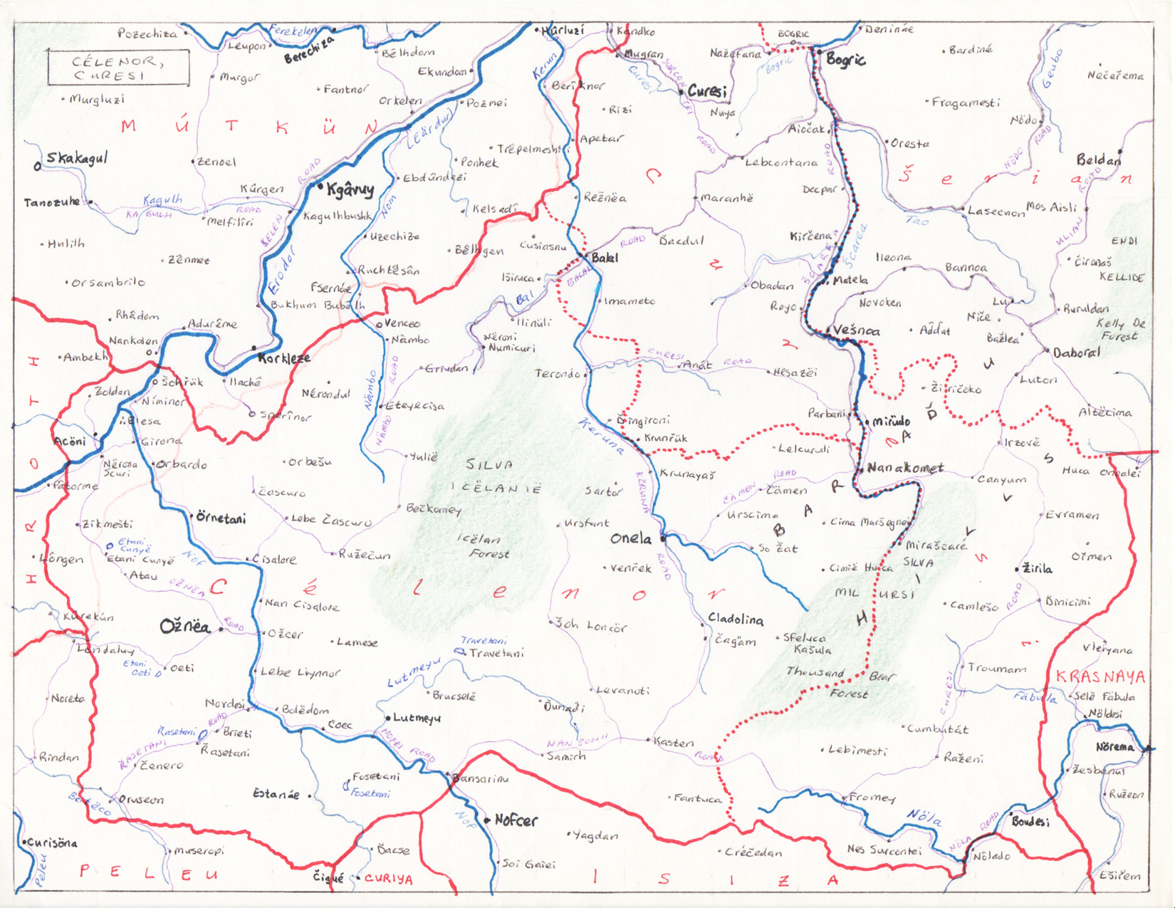
Heck, one more: Célenor and Curesi. This goes with this map of Verduria province.
(Pedantic note: some names on the fringes of the map, especially in Dhekhnam, have changed.)
Some big ol' maps
-
So Haleza Grise

- Avisaru

- Posts: 432
- Joined: Fri Sep 13, 2002 11:17 pm
Re: Some big ol' maps
I don't know why, but my favourites out of these are the Kebri ones. Maybe it's just that they are easy to read, I'm not sure.
Duxirti petivevoumu tinaya to tiei šuniš muruvax ulivatimi naya to šizeni.


Re: Some big ol' maps
I want to check out the town of Funky and meet those gone cats 
A New Yorker wrote:Isn't it sort of a relief to talk about the English Premier League instead of the sad state of publishing?
Shtåså, Empotle7á, Neire WippwoAbi wrote:At this point it seems pretty apparent that PIE was simply an ancient esperanto gone awry.

Re: Some big ol' maps
Great!