Creating a continent
Posted: Wed Dec 07, 2016 8:25 pm
So, I've been reading about Westeros, from George RR Martin's Song of Ice and Fire series. It's made me interested in creating a continent myself, for "fantasy" cultures. Or at least preindustrial ones. I'll post updates as I go if there's interest, comment if you'd like to read more or if you have any advice.
First, some basic rules:
1) The only difference between this planet and contemporary Earth is the arrangement of the continents, and maybe the proportion of land vs sea.
2) The continent is big enough for lots of variation in climate. The model here is Westeros, which goes from Siberia to France to Libya.
3) I'll only create one continent, but it's close enough to others to be settled by waves of migrants. I'm thinking more isolated than Westeros, no daily ships to Pentos. But more interaction than the Almean continents.
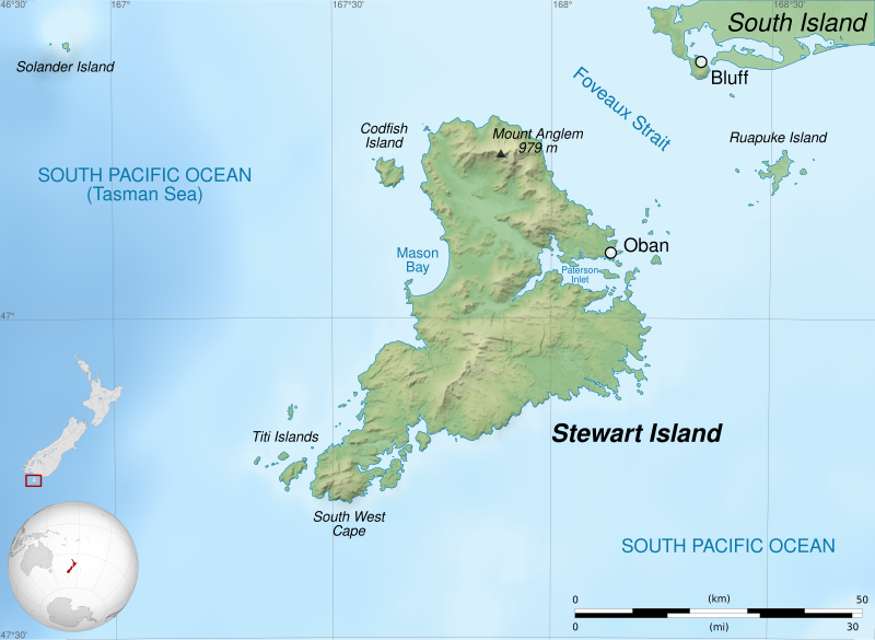
So, the first step is the coastline and topography. I've already mentioned how hopeless I am at doing this, so I have a few different options:
1) Choose a real-world island and expand it to continental size, maybe flipping or rotating it so that the resemblance isn't so egregious. The issue is how self-similar geography really is. For example, look at this picture: https://upload.wikimedia.org/wikipedia/ ... en.svg.png. This island is about half the size of Rhode Island, is there anything implausible about a continent the size of North America looking like that?
2) Use a fractal map generator: https://donjon.bin.sh/world/ You can get a reasonable looking isolated continent if you play around a bit. The only problem is the grid-like artifacts you get from the algorithm. Any opinons how how realistic these continents look?
3) Try drawing the thing freehand, maybe with some computer trickery to make it look better. Any suggestions welcome.
So, which option should I choose?
First, some basic rules:
1) The only difference between this planet and contemporary Earth is the arrangement of the continents, and maybe the proportion of land vs sea.
2) The continent is big enough for lots of variation in climate. The model here is Westeros, which goes from Siberia to France to Libya.
3) I'll only create one continent, but it's close enough to others to be settled by waves of migrants. I'm thinking more isolated than Westeros, no daily ships to Pentos. But more interaction than the Almean continents.
So, the first step is the coastline and topography. I've already mentioned how hopeless I am at doing this, so I have a few different options:
1) Choose a real-world island and expand it to continental size, maybe flipping or rotating it so that the resemblance isn't so egregious. The issue is how self-similar geography really is. For example, look at this picture: https://upload.wikimedia.org/wikipedia/ ... en.svg.png. This island is about half the size of Rhode Island, is there anything implausible about a continent the size of North America looking like that?
2) Use a fractal map generator: https://donjon.bin.sh/world/ You can get a reasonable looking isolated continent if you play around a bit. The only problem is the grid-like artifacts you get from the algorithm. Any opinons how how realistic these continents look?
3) Try drawing the thing freehand, maybe with some computer trickery to make it look better. Any suggestions welcome.
So, which option should I choose?


